Waiting for the Bus in New York City is Hot and Miserable. Here’s Why.
NASA and Transportation Alternatives reveal the 100 spots where New Yorkers swelter waiting for the bus.
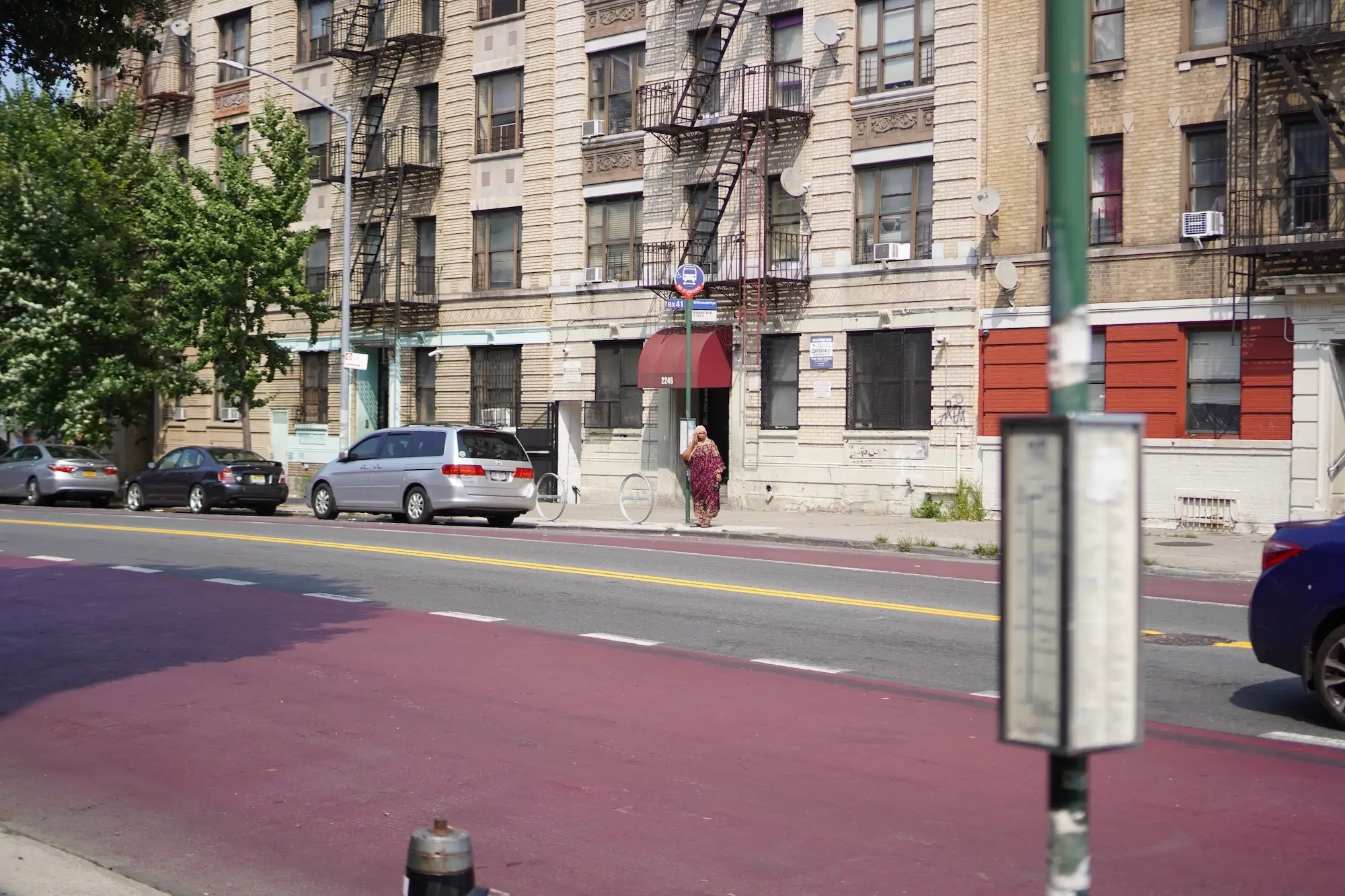
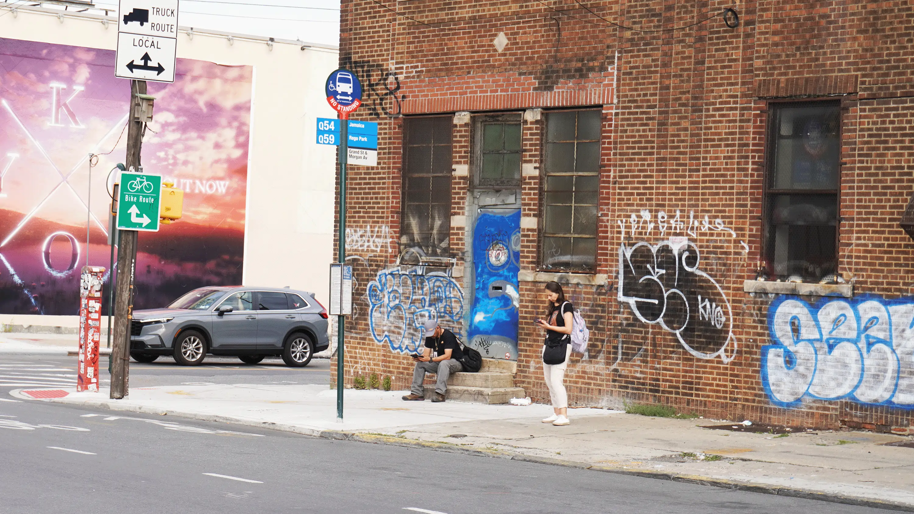
On summer days, New Yorkers stand on sun-baked corners, waiting for buses that may never come. They shelter in the sliver of shade provided by a street light or building and tuck themselves into doorways to hide from the unrelenting heat.
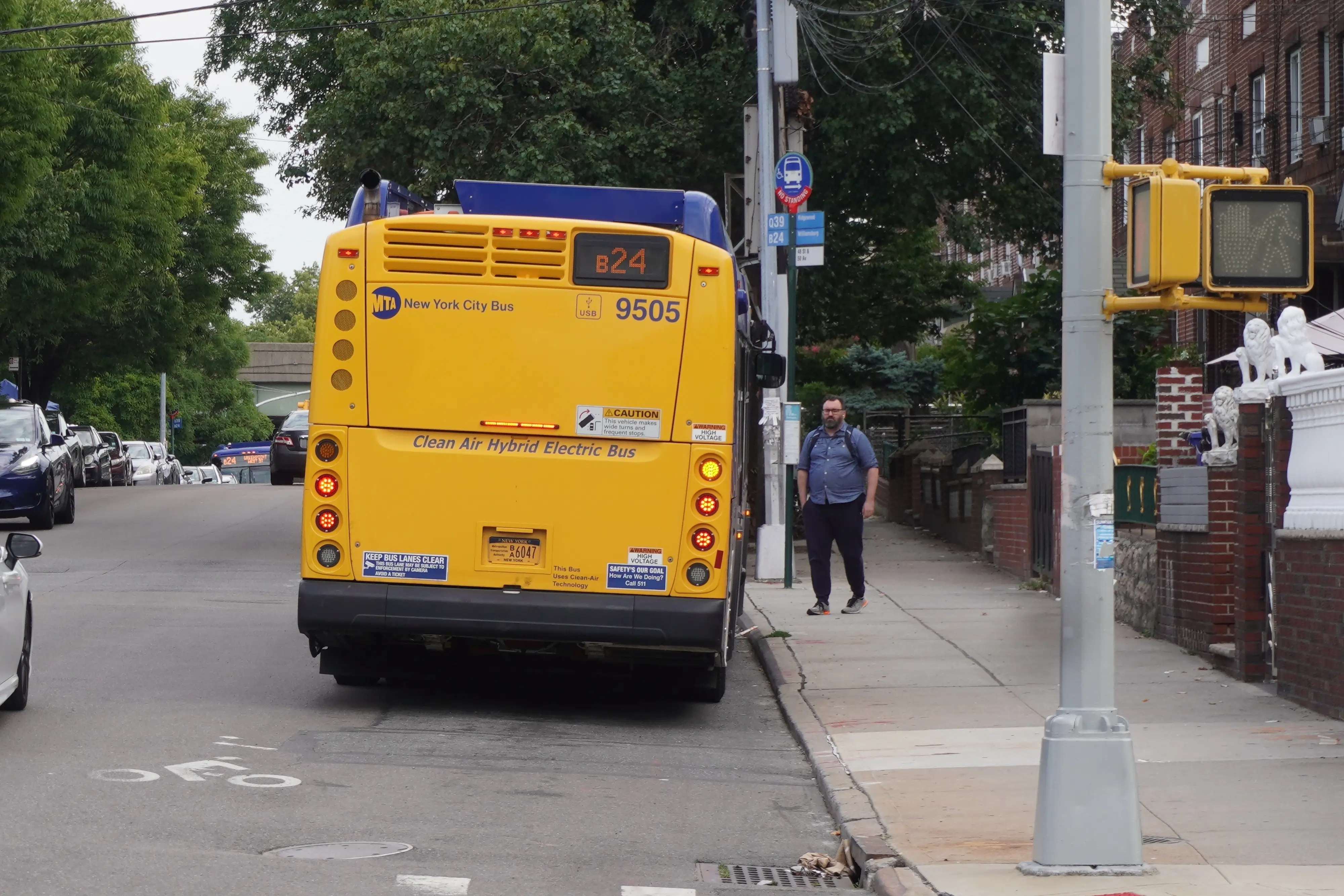
Hundreds of thousands of New Yorkers rely on the nation’s slowest buses for transportation – and the vast majority of them wait for the bus at an unsheltered, unshaded bus stop.
Extreme heat is the leading cause of weather-related mortality in New York City. Summer temperatures continue to break records, and heat waves are expected to triple in number by the 2050s.
Heat exposure kills hundreds annually, and Black residents are twice as likely to die of heat stress as white ones. New York’s bus stops are an under-recognized source of heat exposure for vulnerable New Yorkers.
While climate change has led policymakers to propose new ways to cool homes and businesses, public policy has neglected bus stops. Solutions that will keep bus riders safe and cool are readily available and beneficial to the city as a whole – such as building shelters, planting temperature-cooling street trees, and installing dedicated lanes that speed buses and shorten waits. Today, just one in five bus stops in New York City has a bus shelter, only one in three stops is near the shade of trees, and only 1.87% of streets have a bus lane.
Transportation Alternatives collaborated with the NASA DEVELOP Environmental Justice team to analyze summer daytime temperature data at New York City bus stops using thermal heat imaging satellites. We found that the hottest bus stops are 14.5°F hotter than the coolest – and more likely to be located in Black, Latino, Asian, and high-poverty communities, in Queens and the Bronx, and in the communities with the most bus riders.
Additionally, we analyzed the characteristics of New York City’s hottest and coolest bus stops to find trends in the built environment. We found that the coolest bus stops are more likely to have a bus shelter and be located near street trees, green space, or a body of water.
Based on this data, we identified 100 bus stops and three bus routes for high-priority intervention and outlined recommendations to keep bus riders safe and cool at these stops.
The average bus stop in New York City lacks a shelter, bench, and countdown clock.
Where are New York City’s Hottest Bus Stops and Who Relies on Them?
Low-Income and Non-White Communities Have the Hottest Bus Stops
People living within a quarter-mile of the 400 hottest bus stops are 56% more likely to be Latino, 24% more likely to be Black, and 40% more likely to be non-white than people living within a quarter-mile of the coolest bus stops.
While roughly the same number of residents live near the hottest and coolest bus stops, nearly twice as many white residents live near the coolest bus stops than the hottest.
Half of the 400 hottest bus stops are located in just six City Council districts: 12, 19, 20, 21, 22, and 26. The residents of these Council districts are also 96% more likely to be Asian than in the average district.
People living within a quarter-mile of the hottest bus stops are 62% more likely to live below the federal poverty line than people living within a quarter-mile of the coolest bus stops.
The Bronx and Queens Have the Hottest Bus Stops
The seven hottest bus stops are located in the Bronx, averaging 11°F above the citywide average, and 20°F hotter than the coolest bus stops. The Bronx is home to just 12% of the city’s bus stops, but 27% of the hottest bus stops.
More than half of the 400 hottest bus stops are in Queens. 67% of Queens’ total bus stops are hotter than the citywide average.
The Hottest Bus Stops Have the Most Bus Commuters and the Fewest Shelters
People living within a quarter-mile of the hottest bus stops are 34% more likely to commute by bus than people living within a quarter-mile of the coolest bus stops.
Bronx residents use the bus more than residents of any other borough, and three of every four Bronx bus stops are hotter than the citywide average.
The hottest bus stops are significantly less likely (14%) to have bus shelters than the coolest.
Proximity to Trees and Green Space Cools Bus Stops
There are 69% more street trees near the coolest bus stops than the hottest stops.
The coolest bus stops are nearly ten times more likely to be located within 100 feet of a green space or body of water than the hottest.
Get notified about new reports
Subscribe to get our latest reports, events, and news right in your inbox.
How Can New York City Make its Hottest Bus Stops Safe & Cool?
TA identified 100 bus stops and three bus routes in need of priority intervention. The 100 high-priority stops were identified by five characteristics: excessive heat, poor bus service, few if any alternative transit options, no bus shelters, and predominantly serving New Yorkers who depend on the bus or are low-income, Black, or senior citizens. The three high-priority bus routes are those with six or more priority stops along their route. (See methodology for more information.)
High-priority bus stops and routes
Of the 100 priority bus stops:
All lack bus shelters.
64% have no street tree cover within 25 feet.
There are an average of one-third fewer alternate transit options within a five-minute walk, compared to the average New York City bus stop.
More than half of bus riders who live within a quarter-mile have commutes over 45 minutes long.
Nearly two-thirds are located in just five City Council districts: 8, 11, 17, 42, and 45. The residents of these Council districts are 96% more likely to be Black, 39% more likely to be Latino, and 57% more likely to live below the poverty level than the citywide average. These districts also have asthma rates 88% higher than the average district – a condition exacerbated by the heat.
Transportation Alternatives recommends that New York City’s hottest bus stops be prioritized for the installation of bus shelters and the planting of street trees and greenspaces, as well as bus route improvements to minimize wait times and to improve the experience of waiting.
Specifically, to keep New Yorkers safe and cool while waiting for the bus, TA recommends:
By 2025, install bus shelters with seating and countdown clocks at all high-priority bus stops. Where sidewalks are narrow, reclaim parking spaces to create a bus bulb-out with room for a bus shelter.
Plant trees around priority bus stops where possible under current guidelines. Where sidewalks are narrow, reclaim parking spaces to create a bus-bulbout with room for multiple trees or a parklet.
By 2025, convert high-priority bus routes into express car-free busways or red-painted, bollard-protected, and camera-enforced bus lanes, and expand transit-priority signaling to high-priority bus routes to reduce wait times. (The average New York City bus spends 21% of its time waiting at red lights.)
Require the DOT to release a public dashboard of bus shelter installation to track progress toward full implementation.
Tell your leaders to cool down New York City's hot bus stops
Ask your elected officials to accelerate bus shelter installation and tree planting near bus stops to ensure all bus stops are safe and cool, and to minimize wait times on the hottest bus routes with car-free busways and protected bus lanes.
We mapped every bus stop in New York City using publicly-available data. Find the stops that you use the most and see how they compare to other bus stops around the city.
Temperature impact of urban heat island effect
-10° F
-5° F
0° F
+5° F
+10° F
+15° F
+20° F
The 100 priority bus stops are some of New York City’s hottest, and also have significantly poor bus service, few alternative transit options, little green space, and no bus shelters.
The Bronx
3 Av/E 180 St
3 Av/E 180 St
3 Av/E 184 St
Allerton Av/Laconia Av
Allerton Av/Pearsall Av
Allerton Av/Westervelt Av
Allerton Av/Westervelt Av
E 138 St/Bruckner Bl
E 138 St/Cypress Av
E 138 St/St Anns Av
E 138 St/Walnut Av
E 138 St/Walnut Av
E 138 St/Willow Av
E 149 St/Grand Concourse
E 167 St/Bryant Av
E 180 St/3 Av
E 180 St/Arthur Av
E 233 St/Bussing Av
E 233 St/Carpenter Av
E 233 St/Kepler Av
Eastchester Rd/Astor Av
Grand Concourse/E 149 St
Grand Concourse/E Mt Eden Av
Halleck St/Food Center Dr
Halleck St/Hunts Pt Av
Halleck St/Spofford Av
Halleck St/Spofford Av
Hunts Point Av/Garrison Av
Katonah Av/E 234 St
Katonah Av/E 237 St
Katonah Av/E 239 St
Katonah Av/E 239 St
Longwood Av/Barry St
Longwood Av/Barry St
Longwood Av/Tiffany St
Metropolitan Av/Purdy St
Morris Av/E 156 St
Morris Av/E 163 St
Nereid Av/Edson Av
Nereid Av/Monticello Av
Spofford Av/Bryant Av
Tiffany St/Oak Point Av
Tiffany St/Oak Point Av
Tiffany St/Randall Av
Tiffany St/Randall Av
Viele Av/Casanova St
Viele Av/Casanova St
Viele Av/Faile St
Viele Av/Faile St
Viele Av/Whittier St
W Farms Rd/E 167 St
W Farms Rd/Longfellow Av
Walnut Av/E 133 St
Walnut Av/E 133 St
Walnut Av/E 135 St
Walnut Av/E 135 St
Webster Av/E 182 St
Westchester Av/Home St
Westchester Av/Olmstead Av
White Plains Rd/Arnow Av
White Plains Rd/E 215 St
White Plains Rd/E 239 St
Brooklyn
Av D/E 42 St
Av D/E 43 St
Av H / E 38 St
Erskine St /Gateway Pl
Erskine St/Gateway Dr
Flatlands Av/Atkins Av
Flatlands Av/Elton St
Flatlands Av/Essex St
Flatlands Av/Jerome St
Fountain Av /Flatlands Av
Fulton St/Buffalo Av
Fulton St/Sackman St
Fulton St/Utica Av
Gateway Dr/Erskine St
Glenwood Rd/Albany Av
Glenwood Rd/Albany Av
Glenwood Rd/E 38 St
Glenwood Rd/E 39 St
Kings Hy/Av N
Nostrand Av/Av N
Utica Av/Atlantic Av
Utica Av/Av L
Utica Av/Av M
Utica Av/Farragut Rd
Utica Av/Foster Av
Utica Av/Foster Av
Vandalia Av/Erskine St
Queens
213 St/92 Av
College Pt Bl/Fowler Av
College Pt Bl/Sanford Av
Francis Lewis Bl/89 Av
Francis Lewis Bl/90 Av
Merrick Bl/220 St
Merrick Bl/222 St
Springfield Bl/136 Av
Springfield Bl/Merrick Bl
Staten Island
Forest Av/Clove Rd
Post Av/Greenleaf Av
The three priority bus routes are the routes that intersect with six or more priority stops.
Bx6 route - Hunts Point to Riverside Drive (11 priority stops)
Bx33 route - Port Morris to Harlem (10 priority stops)
B46 route - Kings Plaza to Williamsburg (6 priority stops)
The 100 high-priority bus stops were selected based on five criteria:
The bus stop had to be in the bottom half of all bus stops when ranked by alternate transit options via the Transit Proximity Index (TPI). The TPI was established by the team at NASA DEVELOP by counting the number of other bus stops, subway stations, and ferry stops within a five-minute walk (0.25 mile) radius of a bus stop. The 50th percentile stop had a TPI of 16. Anything with a score lower than 16 qualified to be a priority stop.
The bus stop had to lack a shelter according to NYC Open Data’s Bus Stop Shelters dataset. Shelters were matched to the closest stop within 100 feet.
The bus stop had to receive a failing grade (under 70 points, out of a possible 100) when the grades of each route servicing the stop were averaged. The grades were established from 2019 bus performance data by the Bus Turnaround Coalition, which considers speed, bunching, and on-time performance. Stops serviced only by ungraded routes were given the average grade of the other stops (61.82), which qualified them.
The bus stop had to be in a Neighborhood Tabulation Area (2020) that had any three of the following four qualifications:
Above-average senior population rate (from 2021 5-year ACS data)
Above-average bus commuting rate (from 2022 5-year ACS data)
Above-average Black population rate (from 2022 5-year ACS data)
The bus stops that qualified for the above four metrics were then ranked by their urban heat island impact. The top hottest 100 stops from that list were chosen as high-priority stops. This heat island impact was established by the team at NASA DEVELOP, who used NASA Earth observations from the satellites Landsat 8 TIRS and Landsat 9 TIRS-2 between 2017 and 2022 to determine daytime land surface temperature (LST) at each bus stop. These were compared to a rural reference area – an area of wilderness in Southeastern New Jersey with approximately the same climate and elevation as New York City – which was chosen to represent how New York City might experience summer heat if it were not urbanized. By subtracting the average temperature of the rural reference area, the NASA team could find the urban heat index (UHI) at each stop: the difference in temperature attributable to the urban heat island effect.
The estimated UHI effect here is based on freely available Surface Temperature products from Landsat 8 and 9 satellite data (Collection 2). Estimates are based on six years of hot season data (2017 to 2022). There is some inherent uncertainty in Landsat Surface Temperature measurements and some variability location-to-location in which days were sampled due to factors like clouds. Landsat Surface Temperature measurements are integrated over a space roughly the size of a football field, so the UHI estimates represent both the bus stops as well as their surrounding areas. Finally, it’s important to keep in mind that surface temperature is different than air temperature. Air temperature is measured with thermometers and is more typically used to communicate heat levels to the public. Surface temperatures of some surfaces like pavements and roofs can be hotter than is intuitive.
Public data was accessed in the spring of 2024, and recent updates may not be reflected in our analysis. About 7% of bus stops were left out of our analysis due to duplicate stops or stops removed or added between 2023 and 2024 – these stops are fairly evenly distributed across the city and should not significantly affect our findings.
More information and details can be found in the NASA DEVELOP team’s Technical Report.
Thank You to Our Partners
NASA DEVELOP Environmental Justice team: project lead Thomas Schindelman; team members Emily Culling, Gianna Méndez Germán, and Janna Chapman; advisor Dr. Kenton Ross, NASA Langley Research Center; advisor Lauren Childs-Gleason, NASA Langley Research Center; advisor Dr. Medhi Heris, Hunter College; and fellow Julianne Liu.
Riders Alliance
New York City Environmental Justice Alliance
Stay in the loop
Original research is the backbone of every Transportation Alternatives advocacy campaign. These reports introduce innovative new street designs, import best practices from around the world, and most importantly, hold New York City decision-makers to the highest standard of efficacy.